Python integration of PVGIS API for instantaneous PV results
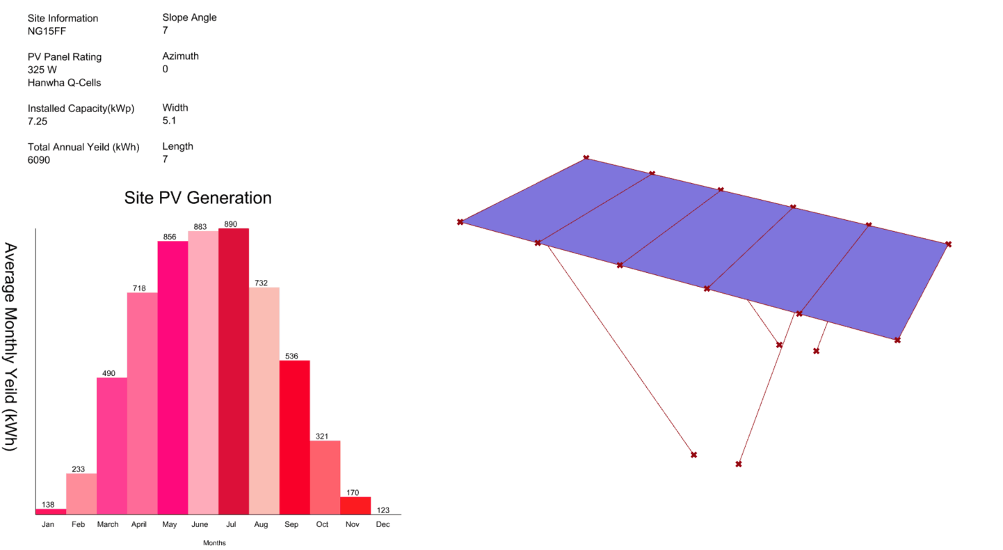
The PVGIS live yield calculator takes the existing grasshopper geometry and extracts the following parameters
Azimuth
Slope
Area
Panel Type (Density)
Assumed Losses
Postcode (which is then used to calculate the latitude and longitude of the site)
The first step is to use a GHpython component that takes the postcode and looks up the latitude and longitude using postcode.io web API.
This is then combined with the PVGIS webtool to generate a concatenated API request link.
All the information for the individual carports is then summed and output to a csv file.
The information is then processed through proving grounds conduit application to generate a HUD dashboard interface that gives all the important metrics of the site.